HUAYHUASH TRAIL PERU
16 Days 6000 ex Lima

Accommodation
8 Nights Camping
7 Nights Hotel

Transportation
Mostly by foot.
Vehicle transfers

Included Meals
15 Breakfasts
11 Lunches
8 Dinners
Trip Grade
Category 4
Extreme Expedition
Off limits.
That was the response when we’d first considered venturing north.
But it wasn’t just to us, the foreigners, as we’d originally believed.
The hills and mountains around these parts, they were home to banditos and the Sendero Luminoso (Shining Path guerillas).
Not even the locals dared venture there, for fear of their lives…
So here we were, half a decade later and the world (at least here) was different.
There was a thrill, but it came from marvelling at soaring, 6,000 metre peaks, and not from the dodging bullets.
There was a shortness of breath, but it was from the efforts of scrambling over scree filled passes, as opposed to fear.
Here we were, finally walking some of the most beautiful and pristine mountains in the world, no crowds, just us and raw nature!

“There is something about mountains that moves the soul.
They arouse a powerful sense of spiritual awareness and a notion of our own transient and fragile mortality and our insignificant place in the universe.
They have about them an ethereal, evocative addiction that I find impossible to resist.
They are an infuriating and fascinating contradiction. Climbing rarely makes sense but nearly always feels right”
Joe Simpson, Touching the Void
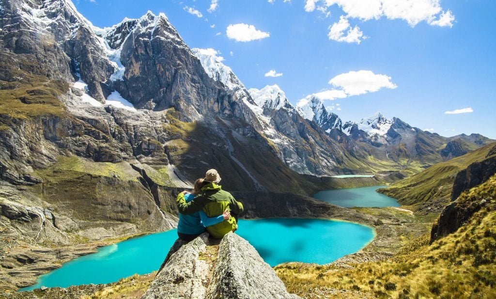
Considered the most beautiful trek in South America and ranking as one of the best on the planet, the Cordillera Huayhuash (pronounced ‘waywash’) is a stunningly picturesque landscape dominated by white snow-capped peaks of 5000 and 6000 metres, tumbling glaciers and high altitude meadows.
Famed as the source of the mighty Amazon river, and for many years the refuge of the Sendero Luminoso (Shining Path) communist guerillas. Today, the guerillas are gone and it remains a sparsely populated region still waiting to be tamed by those intrepid enough.
“The complete Huayhuash circuit has been noted as one of the most physically and emotionally challenging treks in the country, but also one of the most rewarding”
Agnes Rivera, Lonely Planet


The Journey
Arrival to Lima and transfer to hotel.
Lima to Huaraz transfer by public bus (8 hours 30 minutes).
We’ll depart in the morning to arrive in the evening. (B)
Rest day in Huaraz.
This allows time for your body to adjust to the altitude. (B)
Transfer from Huaraz (3100 m) to Santa Cruz (3150 m) and trek to lagoon Wilcacocha (3745 m).
Return to Huaraz and enjoy a free afternoon. (B,L)
Transfer from Huaraz (3100 m) to Pitec (4150 m) and trek to Churup lagoon (4450 m).
Return to Huaraz for another free afternoon. (B,L)
Transfer Huaraz (3100 m) to Quartelhuayn campsite (4150 m) by private transfer.
Departing around 8am and depending on road conditions, this is generally a 5 to 6 hours drive. We will usually find a nice place to stop between Chiquien and Quartelhuain for lunch. (B,L,D)
Trek from our Quartelhuayn campsite (4150 m) through Cacanapunta pass (4690 m) to Laguna Mitucocha, before finishing at Janca campsite, approximately half an hour from the lake on the shores of a stream fed by Mitucocha itself (4250 m).
We’ll enjoy a picnic lunch along the way. (B,L,D)
Trek Janca campsite (4250 m) via Paso
Carhuac (also known as Yanapunta pass) (4650 m) to the Carhuacocha campsite (4200 m).
We’ll usually finish our days hiking early enough for a late lunch at the camp (think 1-2pm) after 4-6 hours of walking. (B,L,D)
Today is a stunner, despite around 8 hours of trekking.
We’ll walk around the Carhuacocha lagoon, passing by 3 others, the Gangrajanca, Siula, and Quesillococha lagoons.
Through Siula pass (4833m) and beyond the Carnicero lagoon to our Huayhuash campsite (4350m).
Picnic along the way. (B,L,D)
NOTE: The trek crew with donkeys, equipment and rescue horse can’t pass through Siula Pass – they take an alternate route via Carnicero Pass. Any trekkers who are struggling or feeling unwell, will also take this route, as any rescue from the Siula pass is a difficult and lengthy operation.
Today, our approximately 7 hour journey from Huayhuash to our Elefante camp, will see us crack the 5000m mark at Trapecio pass, from where more amazing views of the lunar-like landscape can be enjoyed.
Expect an up and down affair today (4 to 4.5 hours to the top of the pass then 2.5 to 3 hours down to Elefante), finished off with campsite views of Nevado Trapecio.
12 km / 7 hours / 900 m height gain / 725 m downhill.
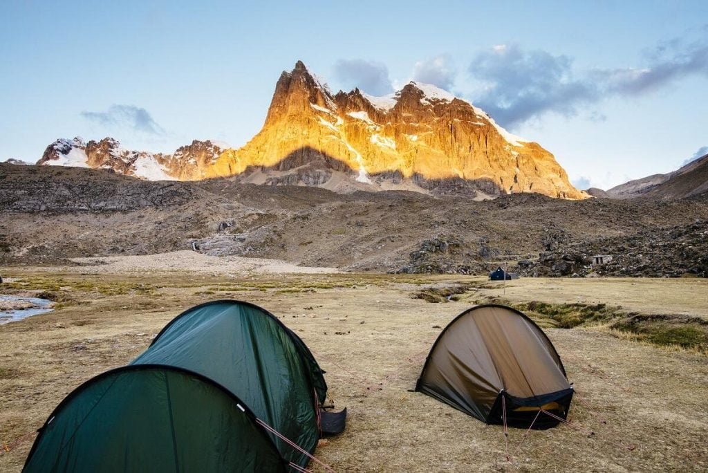
Campsite. Views of Nevado Trapecio (5650 m). (B,L,D)
From camp we climb to a pass (named Santa Rosa or also Jurau Pass) on the mountain range of Cerro San Antonio. This is a demanding day with some steep hiking, but by now you should be well acclimatised and feeling strong at altitude.
After 2 hours we are on the top of the pass at 5000m, with fantastic views of all the giants of the Cordillera Huayhuash and the 3 lakes of Sarapococha, Santa Rosa & Jurau. We can also see the Siula Glacier which Joe Simpson crawled down in his epic battle for survival, and we see Siula Base Camp quite clearly in the distance.
The descent is initially steep on alpine scree for around 200m. It is good to have trekking poles for this section if you are not very comfortable with descending alpine scree. We then traverse & follow a cattle trail winding down to Lake Jurau and finally to our camp in the Quebrada Calinca at Cutatambo in Calinca Valley (4260m).
8 km / 4-5 hours / 600 m height gain
For those with the energy – in the afternoon can hike up to Siula Base Camp and views of the glacier (Joe Simpson – Touching the Void) and Sarapococha Lake.
A harder day today as it is the only day on the trek where we make our climb UP to a campsite in the afternoon. We walk easily back down the Quebrada Calinca, which becomes the agricultural Quebrada Huayllapa valley (the first sign of crops for over a week).
We continue until, just before the tiny village of Huayllapa 3600m, we begin a hard climb in the afternoon of about 3½ hours to our campsite high up on the flat pasture of Huatiac (4265m).
16 km / 7-8 hours / 1350 m mheight gain
(B,L,D)
A longer, tough day, today sees us cross two passes.
First we complete the climb to the Punta Tapush pass (4838m), then descend past Laguna Susucocha for one to 1½ hours to 4528m before turning east and climbing again to the Punta Yaucha (4800m) pass. During the descent the peaks of Rondoy, Jirishanca, Yerupajá, Rasac (6017m) and Sacra come into view.
We follow the Quebrada Huacrish valley to its confluence with the Quebrada Jahuacocha valley and descend on zig-zags to our picturesque camp at the head of the beautiful Laguna Jahuacocha (4060m).
Across the lake from our camp we enjoy one of the best panoramas in the Andes; the west face of the highest peaks in the range rising dramatically skyward. There are Jirishanca, Yerupajá Grande with its vast snaking glacier, Yerupajá Chico and Rondoy.
20 km / 8 hours / 845 m height gain
Views of Nevados Rondoy (5870 m), Jirishanca (6125 m), Yerupajá (6635 m), Rasac (6040 m), Jahuacocha and Solterococha lagoons. (B,L,D)
La ultima dia (the last day)! From our Jahuacocha camp, we’ll complete the final 15km of our Huayhuash trek, along the way passing Laguna Solterococha (another beautiful location for a picnic), the Sambuya pass, before the final descent back to the Quartelhuayn campsite.
From there, our transfer will whisk us back to civilisation. Finally, enjoy the first ‘proper’ bed in days, back in our Huarez hotel!
If you fancy a celebratory drink, why not try one of the locally brewed beers from the Cerveceria Sierra Andina!
15 km / 7 hours (700 m height gain / 700 m downhill.
Accommodation at hotel Andino. (B,L)
Today we will bid farewell to Huaraz, an 8 to 9 hour journey by public bus getting us to the capital Lima by the early evening. (B)
Depart for next destination or stay on for a day or so and explore Lima. (B)
Season
April through to October
NOTE: May through September when the weather is dry but cold is considered the premium time to trek. During the remainder of the year, there can be snow which blocks the mountain passes.
Includes
- 7 nights hotel accommodation
- Transfers from Lima to Huaraz and return
- Service of local UIAGM Mountain Guide
- Service of one auxiliary local Guide
- Transfer Huaraz bus station – Hotel Andino – Bus station
- Private transfer Huaraz – Cuartelhuain
- Private transfer Rondoy – Huaraz
- Muleteers, donkeys and emergency horses
- Food for the whole trek: 8 breakfasts, 8 box lunch, 8 dinners
- Campsite tickets
- First aid kit
- Common camping equipment: sleeping tents for two, mess tent
- Toilet tents, kitchen tent, chairs, tables, kitchen kit, utensils, etc.
- All meals as indicated in itinerary (Breakfast – B, Lunch – L and Dinner – D)
Excludes
- International Flights
- Travel Insurance
- Personal spending money
- Tips for General Guides
- Any meals not listed as included
- Personal trekking gear: sleeping bag, mattress, trekking boots,
- Gore-tex jackets/pants, specific medications, etc.
- Food during stay in Lima and Huaraz
- Extra meals or drinks, tips, etc.
Your Guides and Safety
An excellent guide can make the difference between a trip of a lifetime and just an ordinary trip. Our handpicked professionals come from a range of backgrounds. Each has extensive outdoor experience, a knowledge of the mountains in which you’ll walk, and a passion for the beautiful country that is Peru.
The guide will ensure that your trip is truly inspiring, a huge amount of fun, and safe. All guides are trained in Safety First Aid and are connected to our Lima and Melbourne offices by satellite phone.
Accommodation
This is predominantly a camping expedition, so it’s almost as basic as it can get.
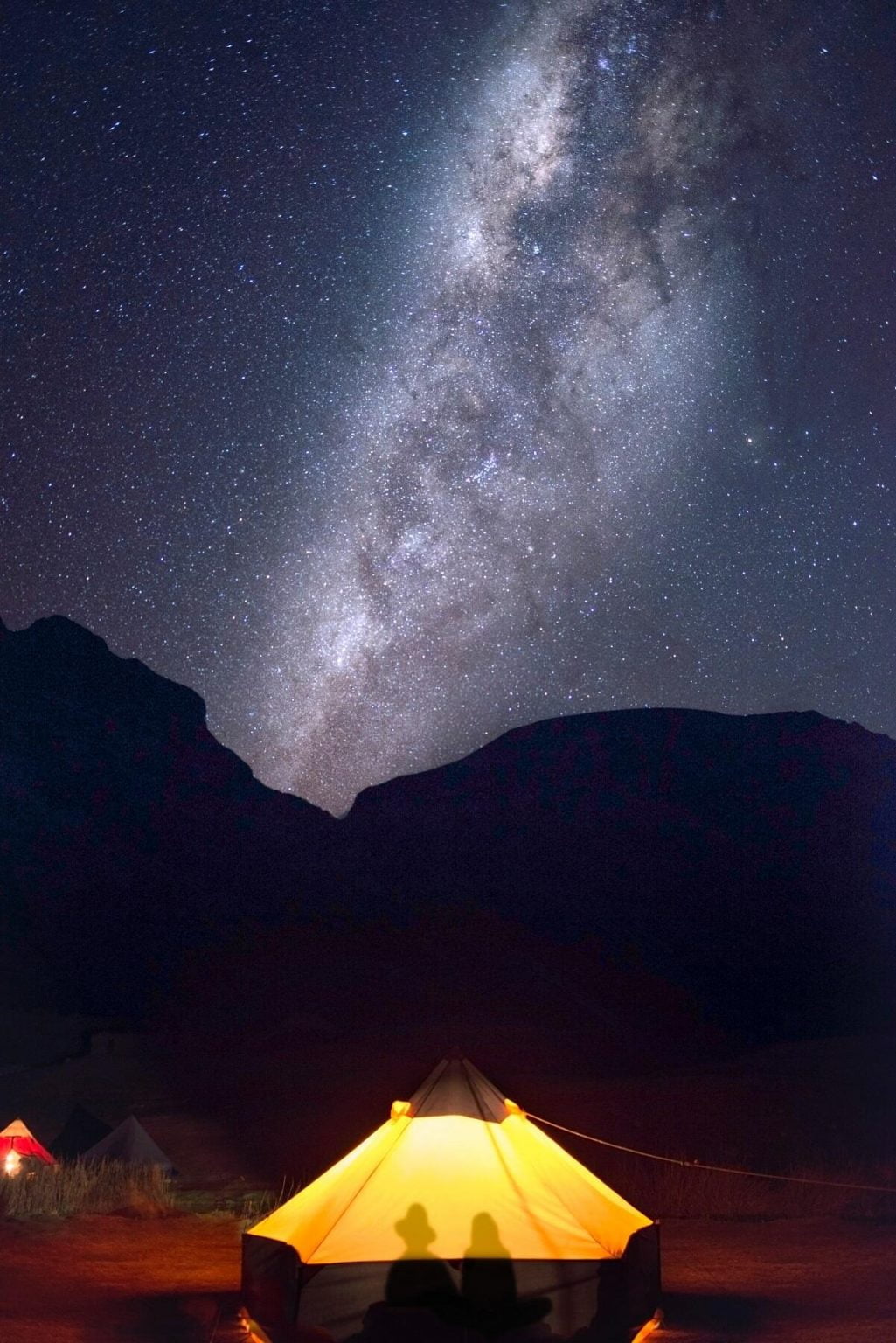
We’ll utilise comfortable hotels in Lima and Huarez, but when we’re out in the mountains, we’re under the stars, protected by a thin veil of nylon.
It’s a raw and real experience, that inserts us fully into our environment.
“Peru’s Cordillera Huayhuash has been called “the best alpine trek in the world”.
Fabled for being the source of the mighty Amazon and having peaks that soar snow-fluted above 6,600m, the Huayhuash is a compact range of 20 main mountains knotted together by blue glacier ice: a place of visual magnificence.
A journey around the entire range is 170km of hard, exhilarating walking, where thin-air passes link jagged mountains, azure lakes and vast skies.”
Gabi Mocatta, BBC Travel


